INDEX
Home Farmer Mountain Farmer Families of Stephens County, Georgia
About Us Our ancestors came to Farmer Mountain in 1839
Photos Here you will find some of our photographs
Contact Us Let us hear from you
Links Some links to sites that may be of interest to you
Log of updates to this website

Ol' Currahee Farmer Mountain
About Ol' Currahee And Farmer Mountain
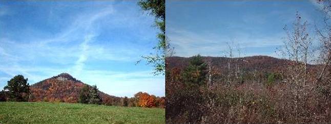
Currahee mountain, "Ol' Currahee" as we know it, and Farmer mountain stand in view of each other. Currahee means "Stands Alone" or "Alone on the Plain" and was named by the Indian tribes that lived around it. Currahee is famous world wide and has stood for centuries as a beacon to the Farmer and other families that lived within its shadow. The phrase, "I wish I could see Ol' Currahee", has been repeated many times, I am sure, by those that have traveled to distant places in the world. I do know that I have uttered the phrase. Always on our return it would be standing in the distance to beckon us home. In 1796, a treaty of peace and friendship between the President of the United States of America and Kings, Chiefs and Warriors of the Creek Nation of Indians, a boundary line was established from the Currahee mountain to the head or source of the main south branch and down the middle of the Oconee river, known by white people as Appalatchee and by Indians as Tulapocka. Source: Indian Affairs: Laws and Treaties. Vol. II (Treaties). Compiled and edited by Charles J. Kappler. Washington: Government Printing Office, 1904. In 1942 the 506th Parachute Infantry received their training at the foot of Currahee and began each day by running 3 miles up the mountain and 3 miles back down. The regimental patch that they wore had the word Currahee and an outline of the mountain on it. There battle cry was "Currahee". Boys who became Men and Brothers in war, as a result of their training in this unit, were from all walks of life and all parts of the United States. Farmer mountain was also a part of the training ground for this unit as was most of the lands around these two mountains. As a young boy I can remember the paratroopers, as we called them, going through their training. Some of this training we were able to observe, i.e. forced road marches and parachute jumps. This made quite an impression on our young minds which was not realized until years later. As youngsters we would try to imitate the paratroopers and I can remember one time making a parachute out of a bed sheet and using it to jump off the top of car shelter. Needless to say the landing wasn't very soft. Years later I joined the military and took basic training in the 506th and still have the regimental crest that I wore in the unit. It has the name Currahee under outline of the mountain. I went on to the 82nd where I used real parachutes to jump out of real airplanes. Farmer mountain was named for our great, great, great grandfather William Farmer. He received a land grant for land on and around Farmer mountain where he lived out his life and where he is buried. Currahee and Farmer mountain is located south of Toccoa in, what is known today as, "The Lake Russell Wildlife Management Area" (LRWMA). Many of us have spent enjoyable hours on and around these mountains just relaxing and taking in the beauty of the area where our ancestors lived, raised their families, died and were buried. If you haven't been there you need to plan a trip into the area to see what you have been missing and when you are there if you listen closely you may hear a soft voice on the wind whispering "Where have you been my children".
![]()
![]()
![]()
![]()
![]() ęCopyright 2004-2020 Howard
Farmer.
ęCopyright 2004-2020 Howard
Farmer.